Not Elsewhere, But Everywhere
2023
ARC3020 & ARC3021 - Research & Thesis Studio: Supernatural Studio
University of Toronto
Instructor: Laura Miller
Over a century ago national and provincial parks were conceived as a respite from an increasingly industrialized society. This dichotomy exempts most of our settled landscapes as being ‘outside’ of Nature. This thesis invents a new typology of peripatetic park: an itinerary constructed between natural protected areas and sites of industry, creating a composite network of discrete zones of conservation, mining, agriculture, human use, education, and tourism. Conflating infrastructures such as rail lines, roadways, and trails, this ‘park’ demonstrates that Nature is not elsewhere, but a part of the everyday, in the intersection of conservation and the post-industrial.
The architectural thesis course "Supernatural" aimed to delve into the intricate connections between the built environment and various natural phenomena. Throughout the course, studio participants worked to critically examine historical and contemporary perspectives on the natural realm and how architecture shapes and is shaped by the natural realm. Studies within the course intended to explore the dissolution of the Nature vs. Artifice dichotomy, with a focus on the Anthropocene era's impact on the environment. Through collaborative research and independent investigations, I and my peers within the studio cataloged and analyzed diverse architectural propositions related to the physical environment and natural phenomena. This exploration culminated in the development of three scenarios for potential thesis focusses, and then through further distillation, a final thesis topic and project, fostering a conscious and informed approach to architecture's interaction with the dynamic and ever-changing natural world.
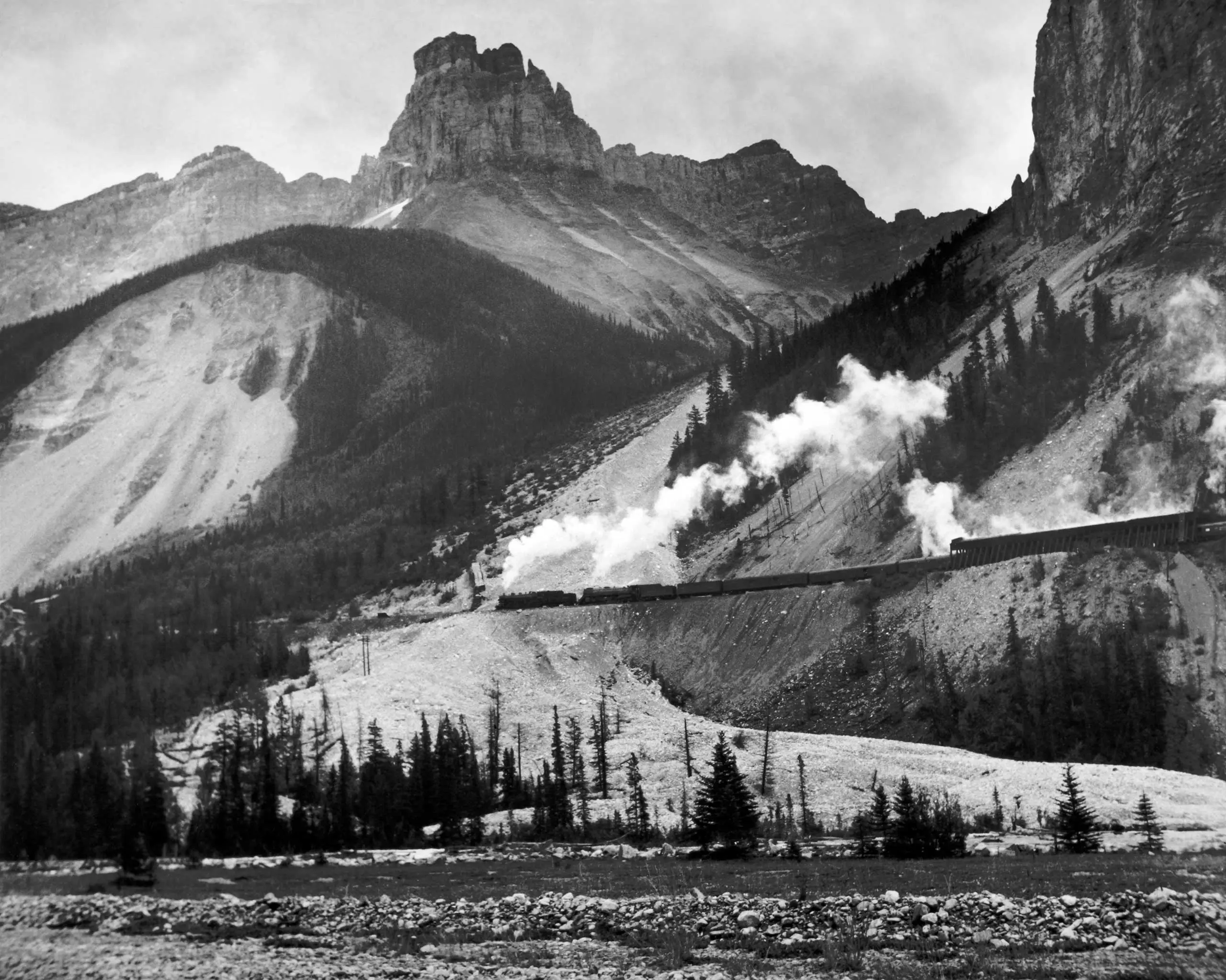
A freight train moves through the mountains of the President Range, Yoho National Park, British Columbia, Canada, National Film Board of Canada, 1951.
" What I celebrate about such places is not just their wildness, though that certainly is among their most important qualities; what I celebrate even more is that they remind us of the wildness in our own backyards, of the nature that is all around us if only we have eyes to see it. "
- William Cronon, The Trouble with Wilderness; Or, Getting Back to the Wrong Nature.
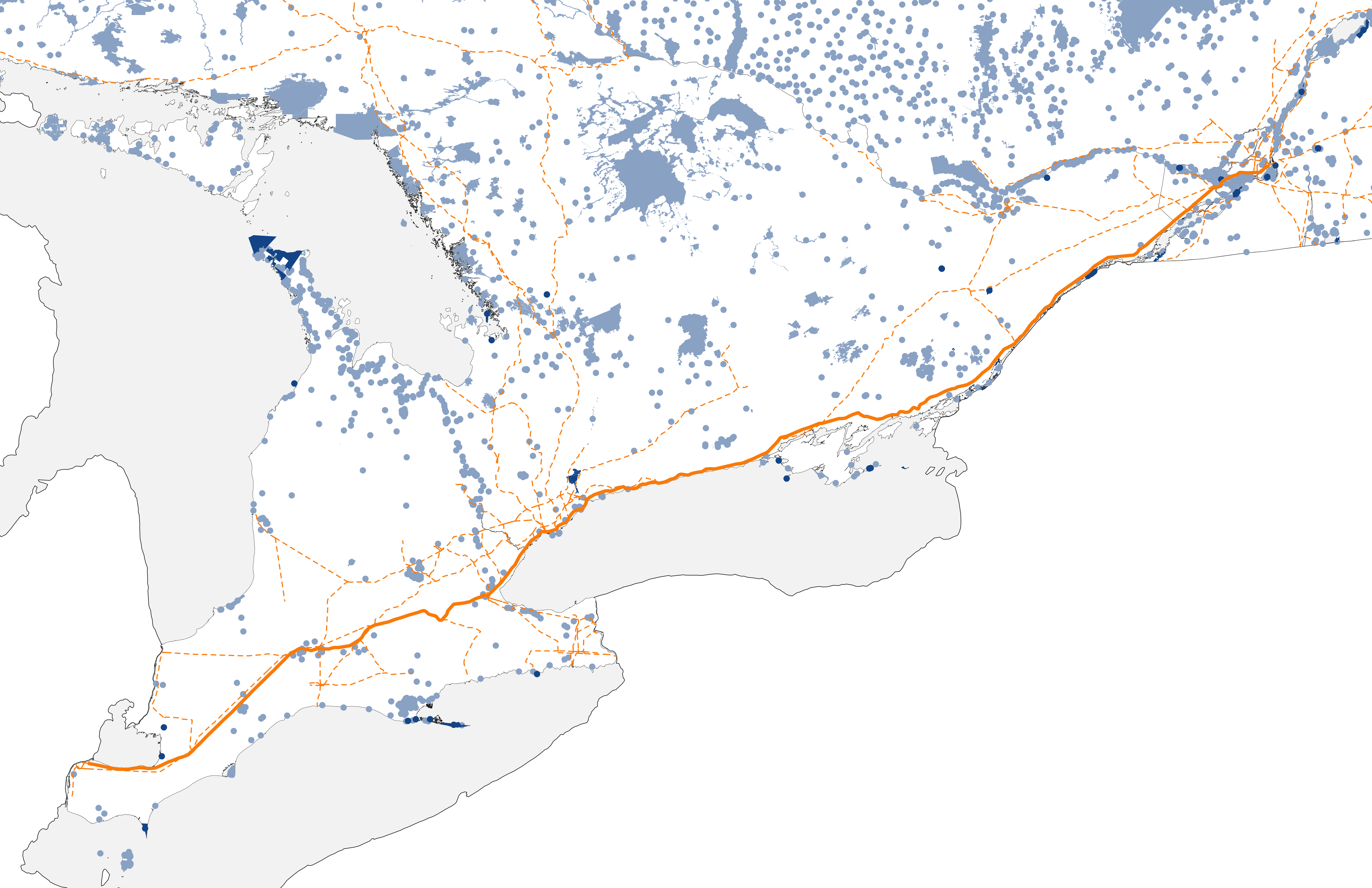
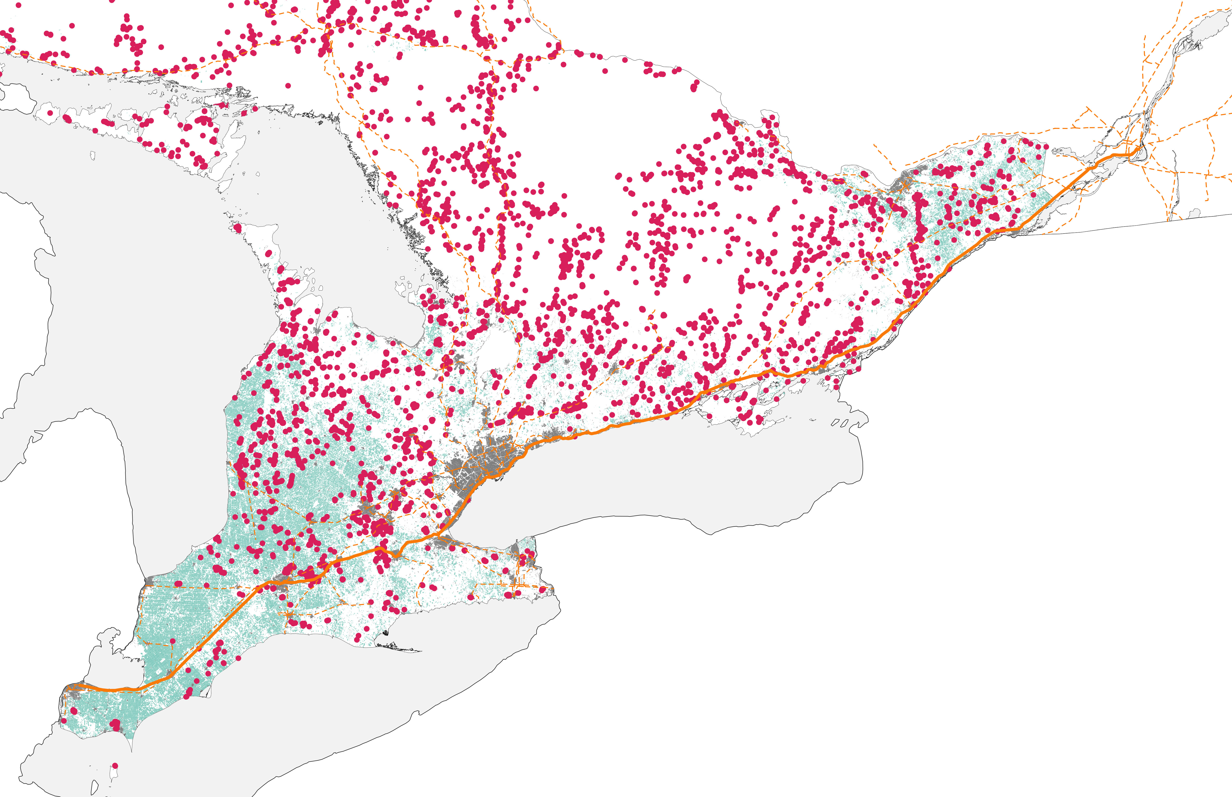
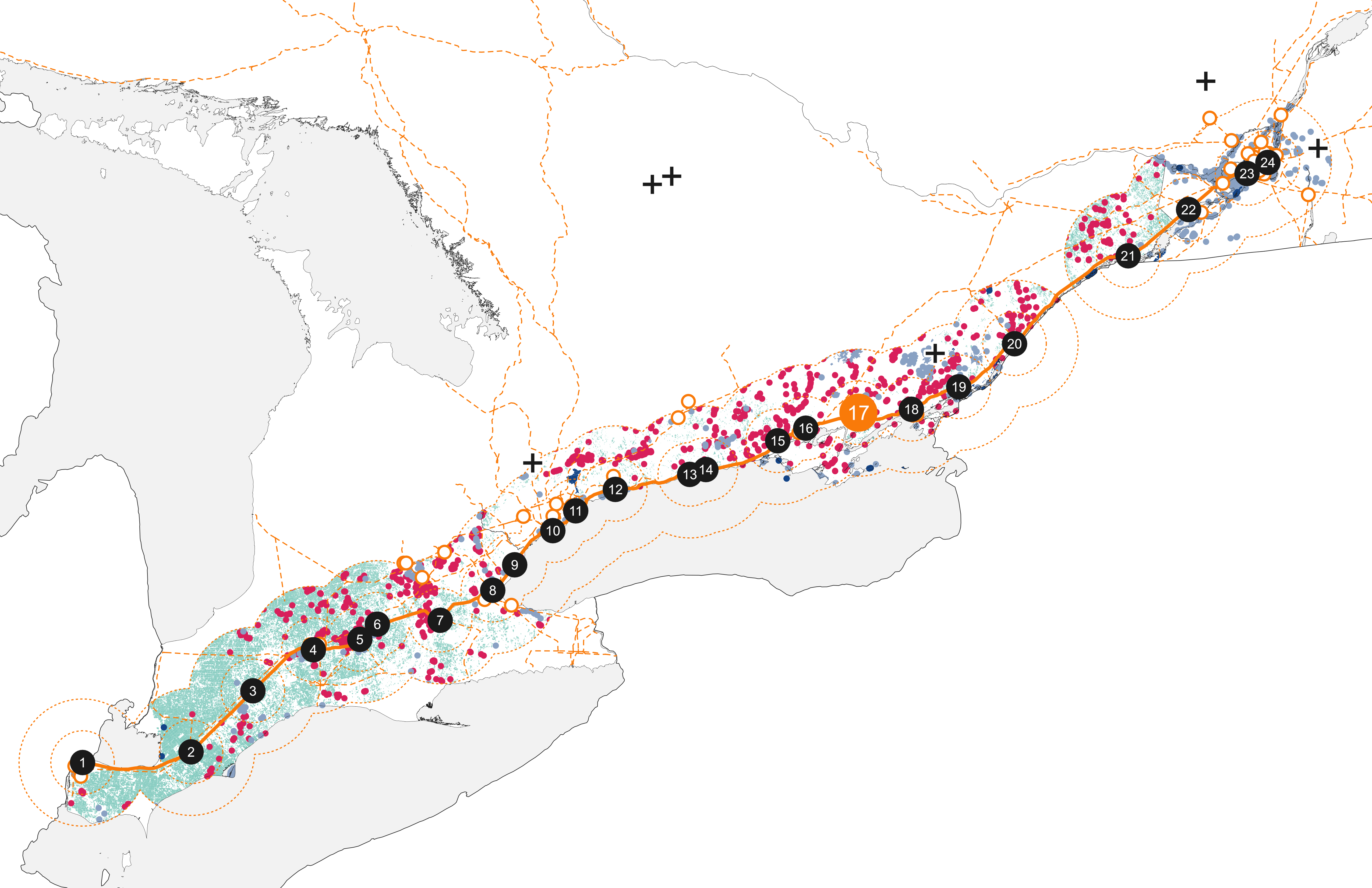
The map encapsulates the core focus of the thesis project, representing the Windsor-to-Montreal railway line, dissected into twenty-four stops along the line of varied size and ridership. This extensive network intersects with diverse natural protected areas, emphasizing the integration of the natural realm into daily human life. Overlaid on this railway network are layers denoting human engagement: urban areas, agricultural properties, and quarries as examples of sites of industry, emblematic of the southern Ontario region's geological context. Moreover, the map pinpoints educational potential, featuring multiple nearby post-secondary institutions and research field stations, crafting an interconnected educational narrative of human-environment coexistence, and understanding.
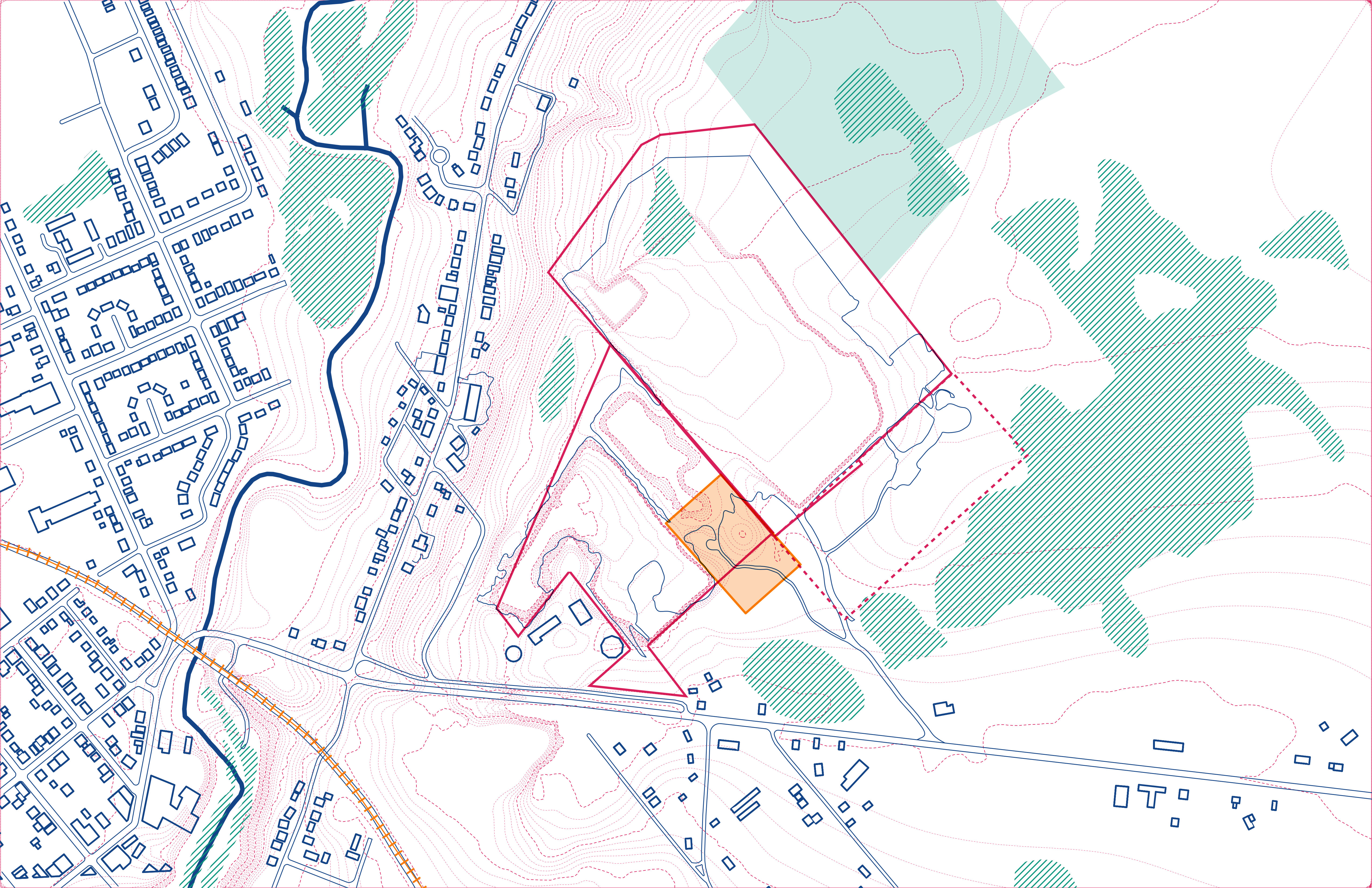
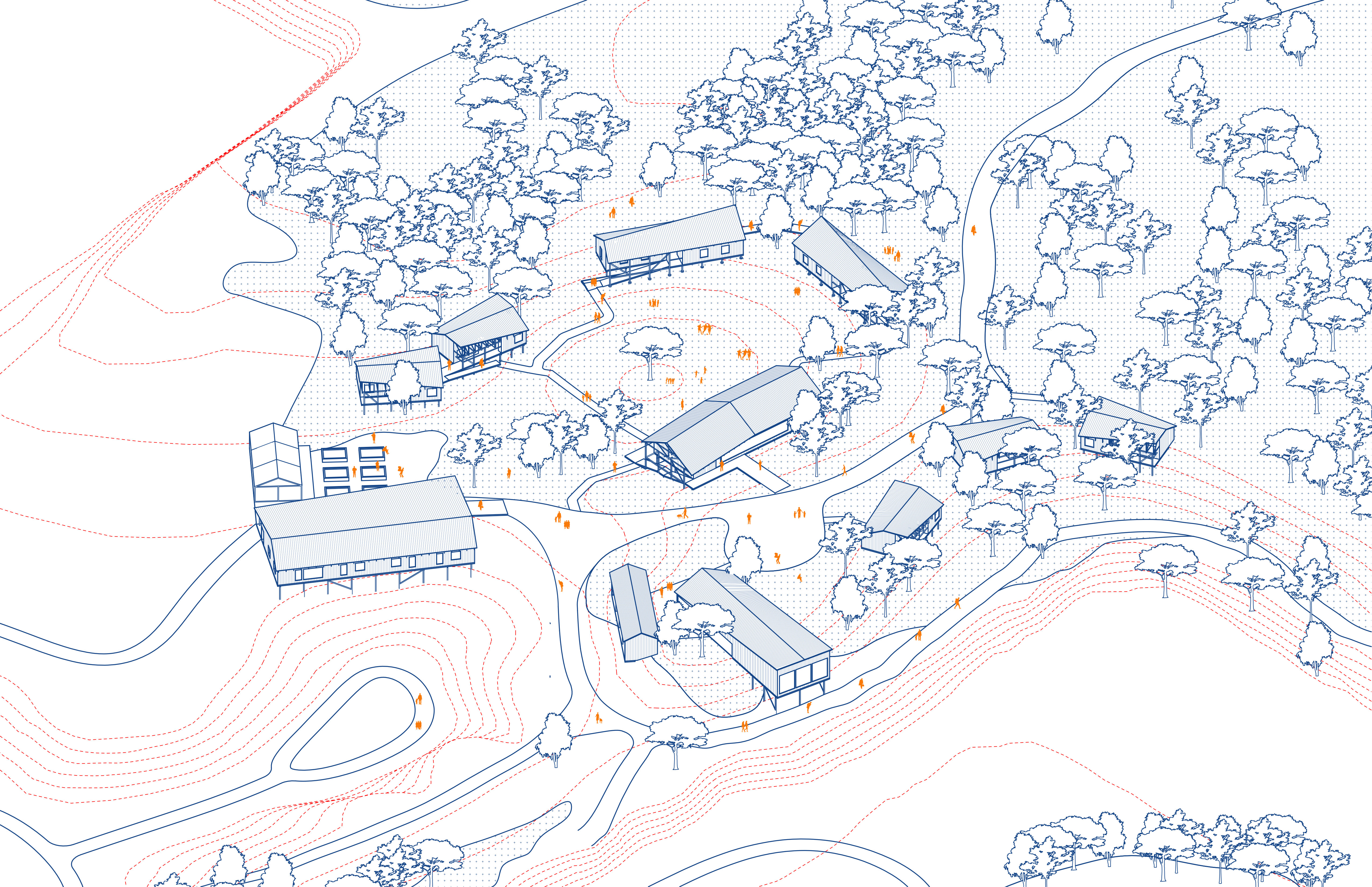
The Napanee field station provides space for the management and operation of the Windsor-Montreal network as well as labs for visiting and full-time researchers. Visiting groups such as local organizations, school groups, or summer camps have space for learning in the field as well as workshops, with simple accommodations on site allowing for guests and partners of the station to stay on site for extended experiences.
Most of the buildings are designed to sit above the ground in order to touch lightly on the land and for flexibility of placement. The buildings of the field station primarily follow the topography of the site creating a central community space between the dining hall and the shared cabins. Programs such as the gathering space sit perpendicular to the topography, protruding over one of the quarries.

The typological buildings are strategically designed to form adaptable units, allowing variability through site placement, exterior decks/patios, and manipulated roof planes. Emphasizing simplified forms, these structures prioritize ease of construction utilizing accessible materials, ensuring replicability across the site. This approach integrates functionality with architectural coherence, resulting in a cohesive yet diverse architectural landscape across the network of sites.


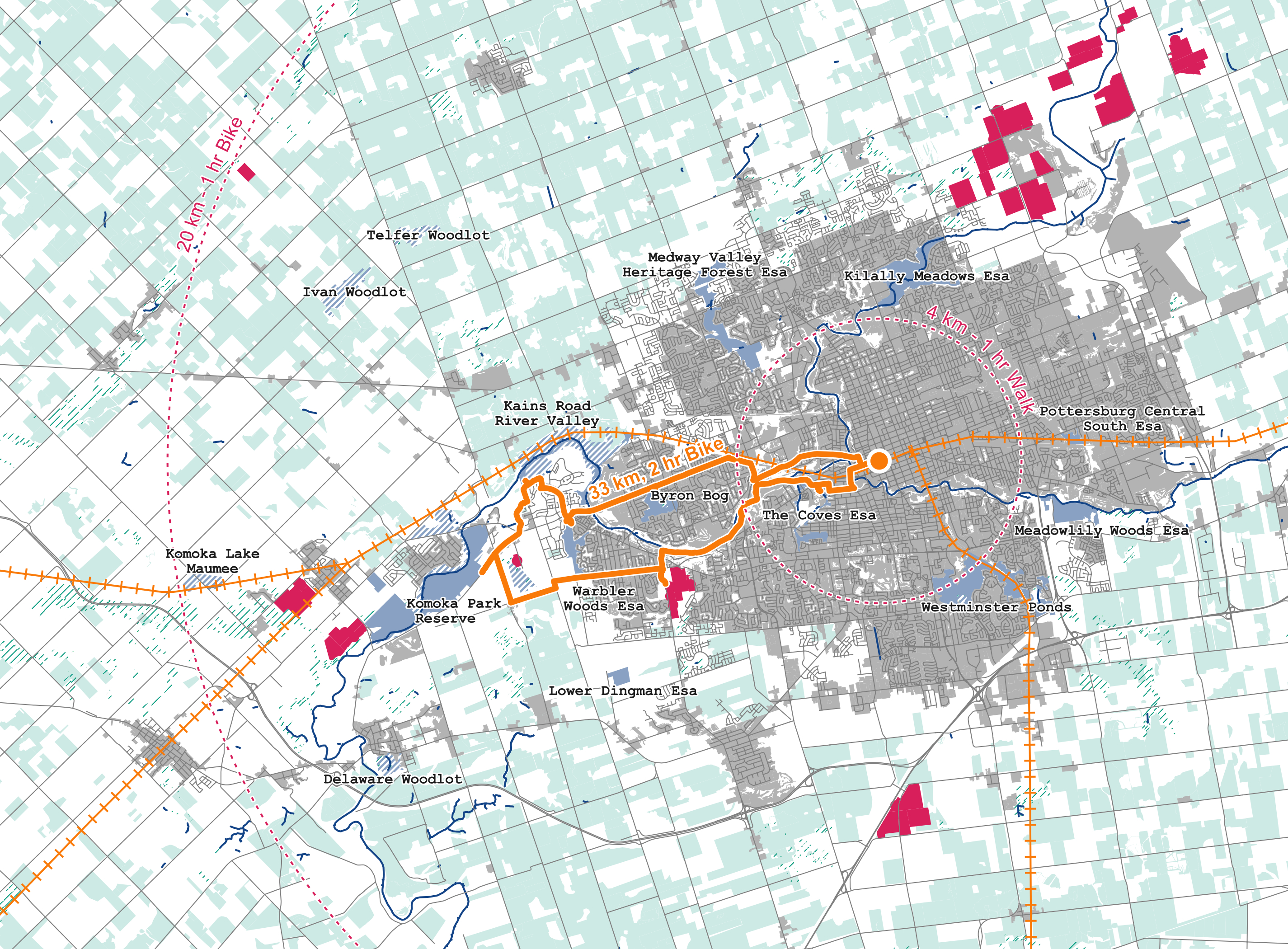
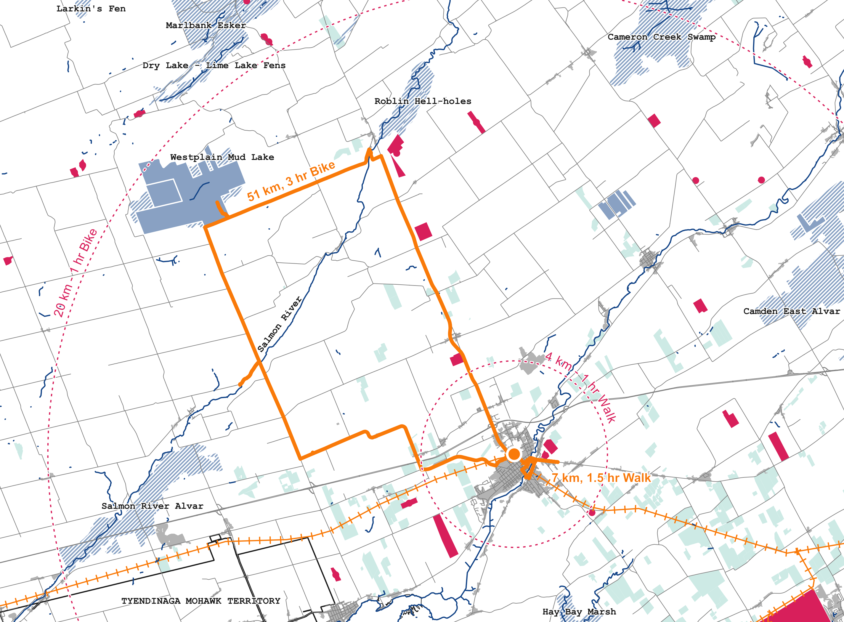
The secondary intention of the Ontario-wide network would be the creation of a comprehensive field guide showcasing natural protected areas and industrial sites along the Windsor-Montreal rail line. This guide meticulously examines each stop, offering insights into conservation areas, agricultural landscapes, and industrial zones like quarries. Illustrated maps spotlight both nature preserves and industry locales, along with suggested walking or biking routes for exploration of these sites. Through historical context and environmental insights, this guide unveils the intricate relationship between the natural realm and Southern Ontario's settlement sites. It unveils the region's flora, fauna, and the nuanced coexistence of diverse environments, rendering this information accessible and visible to all.